Table of Contents
Table of Contents

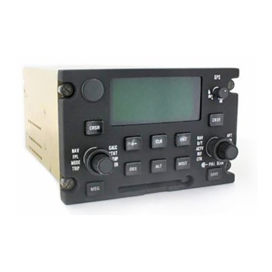
Related Manuals for Honeywell KLN 900s


Summary of Contents for Honeywell KLN 900s
- Page 1 KLN 900 Pilot’s Guide Global Positioning System ORS 01, 02 and 04...
- Page 2 KLN 900 PILOT’S GUIDE 006-08796-0000 for KLN 900s with OPERATIONAL REVISION STATUS (ORS) 01, 02, and 04 IMPORTANT: Special installation procedures must be followed in order for the KLN 900 to be certified for IFR use. Consult the KLN 900 Flight Manual Supplement for the operating limitations of this unit.
- Page 3 THIS PAGE INTENTIONALLY LEFT BLANK Rev 2...
- Page 4 Copyright © 1999 by Honeywell Internationall Inc. All rights reserved. Honeywell International Inc. Electronic & Avionics Systems World Headquarters Business & General Aviation Enterprise One Technology Center 23500 West 105th Street Olathe, KS 66061 U.S.A. Honeywell General Information between 8 a.m. and 5 p.m. Central Time, Monday thru Friday.
- Page 5 OPERATIONAL REVISION STATUS (ORS) IMPORTANT THIS KLN 900 PILOT’S GUIDE IS APPLICABLE TO KLN 900 SYSTEMS WITH THE FOLLOWING LEVELS OF OPERATIONAL REVISION STATUS (ORS): ORS 01, 02, or 04 This ORS level is annunciated in the upper right corner of the Turn-On page each time the KLN 900 system is turned on.
- Page 6 Revision History and Instructions Manual KLN 900 Pilot’s Guide Revision 2, January 1999 Part Number 006-08796-0000 This revision is a complete manual revision and supersedes previous revision level manuals. Superseded manuals should be discarded. Rev 2...
- Page 7 Revision History and Instructions Manual KLN 900 Pilot’s Guide Revision 1, February 1998 Part Number 006-08796-0000 This revision is a complete manual revision and supersedes previous revision level manuals. Superseded manuals should be discarded. Rev 2...
- Page 8 INTRODUCTION The KLN 900 is an extremely sophisticated navigational As you become proficient with using the KLN 900, don’t device, capable of providing highly accurate navigation be tempted to rely on it as the sole means of navigation. over most parts of the world. You will be amazed at all A good pilot never relies on just one source of naviga- of the navigational and other aeronautical functions that tion for either VFR or IFR flying.
-
Page 9: Preview Of Operation
PREVIEW OF OPERATION No doubt you are going to read this entire manual just as displayed after the self test page has been soon as you possibly can. But just to get an idea of how approved. This warning page must be acknowl- edged by pressing E .) easy the KLN 900 is to operate, the following operational preview is presented. -
Page 10: Table Of Contents
TABLE OF CONTENTS INTRODUCTION ................................i PREVIEW OF OPERATION ............................ii CHAPTER 1 - KLN 900 SYSTEM COMPONENTS ....................1-1 CHAPTER 2 - DATABASE ............................2-1 2.1 FUNCTIONS OF THE DATABASE ........................2-1 2.2 DATABASE COVERAGE AREAS AND CONTENTS ..................2-1 2.3 USE OF ICAO IDENTIFIERS ...........................2-3 2.4 UPDATING THE DATABASE ..........................2-3 2.4.1 Computer Updating Of The Database ....................2-4 2.4.2 Card Exchange Updating of the Database ..................2-7... - Page 11 3.9.6 The Navigation 5 Page (NAV 5) .......................3-34 3.9.7 The Super NAV 5 Page ........................3-36 3.10 SPECIAL USE AIRSPACE ALERT ......................3-39 3.11 VIEWING THE WAYPOINT PAGES ......................3-42 3.11.1 Airport Pages ..........................3-42 3.11.2 The Airport 1 Page (APT 1) ......................3-42 3.11.3 The Airport 2 Page (APT 2) ......................3-43 3.11.4 The Airport 3 Page (APT 3) ......................3-43 3.11.5 The Airport 4 Page (APT 4) ......................3-45 3.11.6 The Airport 5 Page (APT 5) ......................3-47...
- Page 12 CHAPTER 5 - LEVEL 3 OPERATION.........................5-1 5.1 TRIP PLANNING ..............................5-1 5.1.1 The Trip Planning 0 Page (TRI 0) .......................5-2 5.1.2 The Trip Planning 1 And Trip Planning 2 Pages (TRI 1 and TRI 2) ..........5-3 5.1.3 The Trip Planning 3 And Trip Planning 4 Pages (TRI 3 and TRI 4) ..........5-5 5.1.4 The Trip Planning 5 And Trip Planning 6 Pages (TRI 5 and TRI 6) ..........5-6 5.2 ADVISORY VNAV OPERATION ........................5-7 5.2.1 VNAV For Direct To Operation ......................5-7...
- Page 13 5.10.4 The Other 8 Page (OTH 8) ......................5-43 5.11 THE AIR DATA PAGES ..........................5-44 5.11.1 The Other 9 Page (OTH 9) ......................5-45 5.11.2 The Other 10 Page (OTH 10) ......................5-45 5.12 MAGNETIC VARIATION ..........................5-46 5.13 OPERATION WITHOUT A DATABASE CARD ...................5-47 5.14 USING THE TAKE-HOME MODE .......................5-48 5.15 CONFIGURATION DATA AND MESSAGES ....................5-48 External Configuration Module ........................5-49...
-
Page 14: Chapter 1 - Kln 900 System Components
The database is designed to be easily updated base card which plugs directly into the front of the unit. by the user by using a laptop computer and Honeywell furnished 3.5 inch diskettes or a database file that has been downloaded from the Honeywell Internet site. - Page 15 Among the GPS Antennas that can be used with the KLN 900 are the KA 91 and KA 92. They are “patch” antennas designed to always be mounted on the top of the aircraft. The KLN 900 has analog outputs to drive the left-right deviation bar of most mechanical CDIs and HSIs.
-
Page 16: Chapter 2 - Database
CHAPTER 2 - DATABASE One reason the KLN 900 is such a powerful navigation system is because of its extensive database. A database is an area of electronic memory used to store a large cat- alog of navigational and aeronautical information. 2.2 DATABASE COVERAGE AREAS AND 2.1 FUNCTIONS OF THE DATABASE CONTENTS... - Page 17 Specifically, all databases contain complete information VORs for all worldwide VORs, NDBs, and minimum safe alti- • Identifier tudes (MSAs). For its primary area, the database con- • Name tains public use and military airports which have any run- • Frequency way at least 1000 feet in length.
-
Page 18: Use Of Icao Identifiers
3C2, 7TX6, and M33. exchange method of database updating is used, Honeywell sends the update so that it arrives prior to the So remember, if you are entering or looking for an next effective date. The new update may be installed any... -
Page 19: Computer Updating Of The Database
Americas, Pacific, and Atlantic data bases during one update cycle. These disks may not, however, be used to update other KLN 900s. Similarly, a unique identification code is encrypted into all database updates downloaded from the Honeywell Internet site. - Page 20 3. When updating from the Internet, download the com- pressed file from the Honeywell www.gpsdatabase.com Internet site following the instructions available at the site. Then, execute Netload.exe from a DOS prompt (not a U P D A T E DOS window running under Windows). The computer...
- Page 21 NOTE: In steps 6, 7, and 8, repeated presses of F will U P D A T E terminate the update process and bring the display back D A T A B A S E to the original SET 0 page shown in figure 2-2. E R A S I N G 9.
-
Page 22: Card Exchange Updating Of The Database
KLN 900. 3. The container which was used to ship the new card to you is used to return the old card back to Honeywell. A return shipping label is included in the container. Remove the backing from the label and place it in the address position of the shipping container. -
Page 23: User Defined Database
2.6.1 Computer Updating of User Data Copying user data via a PC requires the Honeywell PreFlight software in addition to the hardware used for computer updating of the database listed in section 2.4.1. - Page 24 2. Follow the instructions in the PreFlight User’s Manual USER DATA COPY to install and run the transfer program on a Microsoft COPY UNIT TO DB CARD? Windows compatible personal computer. Then, select the “Data Transfer” button on PreFlight’s main menu. COPY DB CARD TO UNIT? COPY UNIT TO PC? 3.
-
Page 25: Card Updating Of User Data
Americas, Pacific, and Atlantic database update services 3. Press the left C. Use the left outer knob to move the from Honeywell. The forms may be mailed or faxed for cursor over the COPY UNIT TO DB CARD? or COPY DB your convenience. - Page 26 Credit card orders Company: may be faxed. Address: Updates from the Internet can be obtained City: directly by logging onto the Honeywell www.gpsdatabase.com Internet site and State: Zip Code: following the instructions provided, or by calling the telephone number below to set Country: up an account.
- Page 27 Tape here...
-
Page 28: Chapter 3 - Level 1 Operation
CHAPTER 3 - LEVEL 1 OPERATION In this chapter you will learn the basic operation of the navigation (navigating from your present position direct to front panel controls and then how to perform Direct To your desired location). 3.1 COVERAGE AREA The KLN 900 was designed to provide worldwide naviga- be manually entered as discussed in section 5.12. - Page 29 KLN 900 CONTROLS POWER/BRIGHTNESS ı 4.7 oq LAX18 | FITON LAX18 arm-«}| 159 uv PUSH .32NM=| ûü161^| †ü170^|5 LEFT CRSR CRSR RIGHT CURSOR CURSOR LEFT RIGHT INNER INNER KNOB KNOB NRST RIGHT LEFT PULL SCAN OUTER OUTER KNOB KNOB SAVE MESSAGE DIRECT CLEAR...
-
Page 30: Turn-On And Self Test
3.2 TURN-ON AND SELF TEST Enough of the preliminaries. Let’s get started into actu- ally turning the KLN 900 on and using it! Figure 3-2 will fold out and allow you to use it as a reference as you read this chapter, especially if you don’t have a KLN 900 immediately at hand. - Page 31 3. Adjust the display brightness to the desired level by rotating the power/brightness knob. Clockwise rota- tion increases brightness and counterclockwise rota- tion decreases brightness. 4. Verify that the data displayed on the left side of the Self Test page is the same as is being displayed on the appropriate equipment in the aircraft which is interfaced to the KLN 900.
- Page 32 The KLN 900 needs to have the correct time, date, and position to be able to determine which satellites should be in view. This information is stored in the battery backed memory of the KLN 900 so it is not normally required to update it.
- Page 33 Samoa Standard Time (UTC - 11) Samoa Daylight Time (UTC - 10) (Note: Local time is available only on ORS 04 and later units.) Local Time (UTC ± offset) You will be able to change the time zone any time you desire on several other pages, so don’t worry if you’re not |DATE/TIME |DATE/TIME...
- Page 34 |DATE/TIME |DATE/TIME 9. To enter the correct baro setting, rotate the right inner 03 AUG 99 03 AUG 99 knob to select the first two digits of the correct altime- |16:28:08UTC |16:27:53UTC ter setting (figure 3-20). Rotate the right outer knob |ALT 1100ft |ALT...
- Page 35 PRESENT POS|=KHIF The NAV 2 page (present position) is now automatically |CLR 124.10 displayed on the left side of the screen and the waypoint --- ---^fr |GRND 121.60 page for the waypoint which was active when the KLN ---- -nm |TWR 126.20 900 was last turned off will be displayed on the right side - --^--.--'|APR...
-
Page 36: Display Format
3.3 DISPLAY FORMAT The KLN 900 uses a Cathode Ray Tube (CRT) display. The display screen is divided into segments. These seg- ments are formed by horizontal and vertical lines on the screen. Most of the time there are five segments as shown in figure 3-28. - Page 37 | KMKC | KMKC You might think of the page types as the chapters in a |ATIS 120.75 |APR 119.00 book and the page numbers as the pages within a chap- |PTAX 121.90 |DEP 119.00 ter. Just as a chapter in a book may have from one to |GRND 121.90 many pages, a KLN 900 page type may have from one to |TWR...
-
Page 38: Basic Operation Of Panel Controls
3.4 BASIC OPERATION OF PANEL CONTROLS Remember that figure 3-2 is on a fold-out page that you may want to refer to as you read this chapter. The KLN 900 has five knobs and ten buttons which are used to perform all operations. In general, the two con- centric knobs and the cursor button (C) located on the left side of the unit are used to select pages and enter data on the left side of the screen. -
Page 39: Page Selection
3.4.1 Page Selection It’s now time for learning to select a desired page. NOTE: The cursor function, which is controlled by the left and right C (cursor) buttons, is not used in selecting pages and the C buttons should not be pressed at this time. - Page 40 You’ve probably already figured out that the right side of the unit operates in a similar manner to the left side. There are, however, a couple of differences. First, the page types are different for the right side except for NAV. The Navigation pages are identical on both sides of the screen.
-
Page 41: Data Entry
3.4.2 Data Entry KLAX -KOAK | KLAX -KOAK | Now that you’ve learned how to select the desired page, 293nm 305^| 293nm 305^| you’re ready to learn the means of entering data. It is 180kt 1:38| 180kt 1:38| necessary to enter data, for example, in order to specify a FF: 00030.0| FF: 00030.0| Direct To waypoint of your choice. -
Page 42: Alternative Waypoint Data Entry Method
3.4.3 Alternative Waypoint Data Entry Method P.POS-KDEN | KLAX There is another method of data entry for waypoints 701nm 055^|LOS ANGELES which you will sometimes find convenient. This method 180kt 3:54| INTL applies when there is a page on the left side of the screen FF: 00030.0|CL B with the cursor over a field where a waypoint is enterable. -
Page 43: Message Page
3.5 MESSAGE PAGE Whenever the KLN 900 determines that there is a situa- PRESENT POS|=KMKO tion that requires your attention, the MSG prompt begins |UNIC 122.80 flashing in inverse video at the bottom of the display just 086^fr|CTAF 122.80 to the right of the mode of operation (figure 3-55). A 24.4nm|PCL 122.80 remote message annunciator may also be installed in the... -
Page 44: Initialization And Time To First Fix
3.6 INITIALIZATION AND TIME TO FIRST FIX Since the KLN 900 stores its position and other required parameters in memory when power to the unit is removed, it is seldom necessary to aid the unit in reaching a NAV ready condition. The time required from power on until the KLN 900 determines its present position and is therefore ready to navigate is called “time to first fix.”... - Page 45 1. Select the Setup 1 page (SET 1) by first turning the left outer knob to display a SET type page. Next, turn the left inner knob until the SET 1 page is selected (figure 3-57). INIT POSN 2. Press the left C to bring the cursor on the page over WPT: N 37^39.00'| the WPT field (figure 3-58).
- Page 46 NOTE: The groundspeed (KT) and heading ( °) fields are not used for actual initialization in an aircraft. However, if the KLN 900 is in the take-home mode, entering a groundspeed will allow the KLN 900 to “fly” along the active flight plan (or to a direct-to waypoint) starting from the initialization waypoint.
-
Page 47: Selecting Waypoints
3.7 SELECTING WAYPOINTS There are five types of waypoints: airports, VORs, NDBs, intersections, and supplemental. Waypoints in the pub- lished database (those in the cartridge) fall into one of the first four types. Remember that you can create up to 1000 (250 for ORS 01 units) of your own waypoints which you may designate as one of the first four types or you may designate it as a supplemental waypoint which sim-... -
Page 48: Selecting Waypoints By Scanning
Did you notice that as you entered the “K” in step 3 that the second and third characters also changed? That is because every time you enter a character (in this case the “K”), the KLN 900 searches its database to offer the first waypoint in the database which begins with the char- acters you have already entered. -
Page 49: Nearest" And "Complete" Waypoint Scan Lists
3.7.3 “Nearest” And “Complete” Waypoint Scan Lists There are actually two waypoint scan lists for airports, VORs, and NDBs. These two lists are the “complete” list and the “nearest” list. The complete list contains all of the waypoints in the database for a waypoint type (all the air- ports for example). -
Page 50: Nearest Airports In An Emergency
5. Turn the left inner knob to select either HRD SFT or to select HRD. If HRD SFT is chosen, then both hard and soft surface runways meeting the required runway length will be included in the nearest airport list. If HRD is chosen, then only hard surface runways will be included. -
Page 51: Continuous Display Of Nearest Airport
3.7.3.2 Continuous Display Of Nearest Airport When the nearest airport page is initially displayed, “NR 1” is displayed in the upper right hand corner of the page to designate this airport as the nearest airport. However, if you continue to fly along your flight plan with this page selected, the same airport will be displayed and its posi- tion in the nearest airport list will change from NR 1 to NR 2, NR 3, NR 4 ... - Page 52 4. Turn the right inner knob to display the first character | ABB D |PNE of the waypoint name, “N” in this case (figure 3-78). |NABB PHILADELP |HIA 5. Turn the right outer knob one step clockwise and then |112.40 |112.00 10^W use the right inner knob to enter the second character, |N 38^35.33'...
- Page 53 11.Rotate the right outer knob one more step clockwise | KONP | KPHF to position the cursor over the fifth character. |NEWPORT MUN |NEWPORT NEW 12.Pull the right inner knob to the “out” position (figure 3- 84). Once again rotate the knob to scan through all |N 44^39.82' |N 37^07.91' the airport names beginning with “NEWP”.
-
Page 54: Direct To Operation
3.8 DIRECT TO OPERATION The D button is used to initiate Direct-To operation (navigation from your present position direct to your desti- DIRECT TO: | nation). When D is pressed, the Direct-To page is dis- KDEN played on the left side with a flashing cursor over a way- point identifier (figure 3-87). -
Page 55: Direct To-Procedure 1
3.8.1 Direct To-Procedure 1 DIRECT TO: | DIRECT TO: | 1. Press D. The Direct To page is displayed on the left side (figure 3-87). The cursor will already be on the left page. A waypoint identifier may or may not be displayed, it doesn’t matter at this point. -
Page 56: To Recenter The Deviation Bar
3. Press E to approve the waypoint page displayed on PRESENT POS| $=KOSH the right side. The right side will now display the NAV |+++++Ê+++++ 1 page, and the left side will return to the page which 045^fr|DIS 683nm was displayed prior to pressing D (figure 3-96). If 15.2nm|GS 193kt the Direct To was started while the NAV 1 page was... - Page 57 THIS PAGE INTENTIONALLY LEFT BLANK 3-30 Rev 2...
-
Page 58: The Navigation
3.9 THE NAVIGATION PAGES As you would expect, the NAV (navigation) pages contain information relating specifically to the KLN 900’s naviga- tion capabilities. The KLN 900 has five NAV pages. Unlike any other pages, these pages may be selected and viewed on both the left and right sides of the screen. The procedure for selecting specific pages, including the NAV pages, was described in section 3.4.1, “Page Selection.”... -
Page 59: The Super Nav 1 Page
3.9.2 The Super NAV 1 Page $=KOSH When the NAV 1 page is selected on both the left and right sides at the same time, the Super NAV 1 page is displayed (figure 3-102). The Super NAV 1 page contains 683nm 3:34 exactly the same information as the standard NAV 1 page... - Page 60 • Minimum Safe Altitude for present position (MSA) - clear all reference points by 1000 feet in areas where IMPORTANT: The minimum safe altitude displayed the highest reference points are 5000 feet MSL or is the altitude defined by Jeppesen as “Grid Minimum lower.
-
Page 61: The Navigation 4 Page (Nav 4)
3.9.5 The Navigation 4 Page (NAV 4) The NAV 4 page (figure 3-107) is used for altitude alerting 6200ft| and for advisory vertical navigation (VNAV). The opera- 6300ft| tion of altitude alerting is described in section 3.15 and SEL: 3500ft| the operation of VNAV is described in section 5.2. - Page 62 entation field (figure 3-111). Rotate the appropriate inner knob to display N? for North up, DTK? for desired track up (figure 3-112), TK? for actual track up (figure 3-113), or HDG? for heading up (figure 3-114). The heading up selection is not presented as a choice if heading is not provided to the KLN 900.
-
Page 63: The Super Nav 5 Page
3.9.7 The Super NAV 5 Page Regardless of whether you ultimately learn to use just the Direct To capabilities of the KLN 900 or whether you mas- ter all of its sophisticated features, you will definitely want to learn how to use the Super NAV 5 page! The Super NAV 5 page provides you with a true moving map display of your present position and route of flight in relation to nearby navaids and airports. - Page 64 Like the NAV 5 page, the Super NAV 5 page shows a graphics depiction of the direct to waypoint or the way- points making up the active flight plan. But surprise num- ber one is that the Super NAV 5 page shows alphanu- meric waypoint identifiers on the graphics display to make orientation even easier for you.
- Page 65 The last surprise for this page is that it is possible for you to change the active waypoint to any of the flight plan waypoints without having to leave this very useful page. 9.0 oq This is done by pulling on the right inner knob to place it in the “out”...
-
Page 66: Special Use Airspace Alert
3.10 SPECIAL USE AIRSPACE ALERT The KLN 900 database contains the location of areas of special use airspace (SUA). The types of SUA areas stored in the database and the abbreviations used to denote these areas are the following: Class B CL B Class C CL C... - Page 67 stored as “cylinders” of airspace so all altitudes below the CAUTION: Failure to keep the altimeter baro setting upper limit of these areas are considered to be in the updated will result in inaccurate special use airspace SUA. alerting. If this feature is used, it is a good idea to update the altimeter baro setting on the ALT page The message prompt for a special use airspace alert will each time you make a change to an aircraft’s altime-...
- Page 68 The SUA alert feature may be disabled (or enabled) on AIRSPACE AIRSPACE the Setup 8 (SET 8) page, shown in figure 3-129. After ALERT ALERT displaying the SET 8 page on the left side, press the left ENABLE DISABLE C to turn on the left cursor function. The left inner knob is used to display AIRSPACE ALERT ENABLE or AIR- VERT BUFFER| SPACE ALERT DISABLE.
-
Page 69: Viewing The Waypoint
3.11 VIEWING THE WAYPOINT PAGES You learned in section 3.7, “SELECTING WAYPOINTS”, the different means of selecting the desired waypoint. You will now see what information may be displayed for each of the waypoint types (airport, VOR, NDB, intersec- tion, and supplemental). 3.11.1 Airport Pages There are eight airport pages (APT 1, APT 2, ..., APT 8) for every airport in the published database. -
Page 70: The Airport 2 Page (Apt 2)
3.11.3 The Airport 2 Page (APT 2) |=KORL See figure 3-135. |ORLANDO • Airport identifier. An arrow precedes the identifier if it |ELV 110ft is the active waypoint. |Z-05(-04DT) |ILS • The city where the airport is located. APT 2 Figure 3-135 •... - Page 71 The primary APT 3 page (figure 3-137) follows the run- |=KORL way diagram. Runway designation, lighting, and types of | RT 25 surface for up to five runways are displayed in order of |07 /25 length, beginning with the longest. Since there are many 5998' HRD times when all of an airport’s runway information does not |13 /31...
-
Page 72: The Airport 4 Page (Apt 4)
3.11.5 The Airport 4 Page (APT 4) |=KORL See figure 3-138 |ATIS*127.25 |CLR *118.05 The APT 4 page is used to display communication fre- |GRND*121.40 quencies for the selected airport. |TWR *118.70 |CTAF*118.70 • Airport identifier. An arrow precedes the identifier if it APT[4 is the active waypoint. - Page 73 The frequencies associated with CL B, CL C, TRSA, |=KORL CTA, or TMA are VFR frequencies. Airports which have |APR 121.10 one of these categories of frequencies also have APR | REF: KMCO and DEP which are IFR frequencies. | 311^- 60^ | BEL 5500ft Where required, APR, DEP, CL B, CL C, TRSA, CTA, and TMA frequencies are sectorized.
-
Page 74: The Airport 5 Page (Apt 5)
3.11.6 The Airport 5 Page (APT 5) The Airport 5 page is used to store and display user- entered remarks. These remarks might include informa- tion on lodging, dining, airport services, phone numbers, or anything else you desire to record for later use. Up to 100 airports may contain these remarks. -
Page 75: The Airport 6 Page (Apt 6)
3.11.7 The Airport 6 Page (APT 6) |=KORL The APT 6 page shows aeronautical services available for the selected airport. These services include customs, fuel, |100 JET and oxygen availability as well as an indicator to denote the presence of a landing fee. Refer to figure 3-146. |NO OXYGEN |NO FEE INFO •... -
Page 76: The Airport 7 Page (Apt 7)
3.11.8 The Airport 7 Page (APT 7) =KFNL KLAX The APT 7 page shows the Standard Instrument NO SID/STAR SELECT STAR Departure (SID) and Standard Terminal Arrival Route FOR THIS 1 CIVET4 (STAR) procedures that are available for the selected air- AIRPORT 2 DOWNE4 port. -
Page 77: The Ndb Page
3.11.11 The NDB Page |=OWI The NDB page shown in figure 3-153 for Ottawa NDB is |OTTAWA used to illustrate the contents of an NDB page. |FREQ • NDB identifier. An arrow precedes the identifier if it is |N 38^32.55' the active waypoint. -
Page 78: The Supplemental Waypoint Page (Sup)
3. Rotate the right outer knob until the cursor is posi- |=KENZY |=KENZY tioned over the identifier adjacent to REF (figure 3- |REF: |REF: 156). |RAD: 152.2^ |RAD: 152.2^ |DIS: 3.7nm |DIS: 3.7nm 4. Use the right inner and outer knobs to select the |N 39^13.25' |N 39^13.25' desired identifier (figure 3-157). -
Page 79: Frequencies For Nearest Flight Service Stations
3.12 FREQUENCIES FOR NEAREST FLIGHT SERVICE STATIONS The KLN 900 stores in its database the locations of Flight Service Stations (FSS) and their remote communications sites. In addition, the KLN 900 determines which two of these FSS points of communication are closest to your present location. -
Page 80: Viewing And Setting The Date And Time
3.14 VIEWING AND SETTING THE DATE AND TIME The KLN 900 system time and date should seldom, if ever, require updating because they are automatically updated when at least one satellite is received. In addition, the KLN 900 contains an internal battery powered calendar clock to keep system time and date when the unit is not being used. - Page 81 If it is required to set the time: DATE/TIME | DATE/TIME | 11 SEP 99| 11 SEP 99| 1. Turn the left knobs until the SET 2 page is visible on 21:23:04UTC| 16:23:04CDT| the left side. CORD UNIV/Z| CENTRAL DAY| MAG VAR: MAG VAR: 2.
-
Page 82: Altitude Alerting
3.15 ALTITUDE ALERTING If your aircraft does not already have an altitude alerting capability you may wish to use the KLN 900’s capability of assisting you with altitude management during your flying. Altitude alerting allows you to select a target altitude and it ALTITUDE |VNV INACTV then provides you with an aural alarm 1000 feet prior to... - Page 83 5. Enter the selected altitude one digit at a time in the SEL ALTITUDE |VNV INACTV field of the NAV 4 page by using the right outer knob to position the cursor over the desired digit and the right BARO:30.09"|IND 09000ft inner knob to change the digits until the entire selected ALERT: ON =|SEL:04000ft altitude is displayed (figure 3-180).
- Page 84 CAUTION: The altitude alerting feature will only be accurate if the altimeter baro correction is kept ALTITUDE updated. If altitude alerting is used, it is a good idea to ALERT VOLUME: update the altimeter baro set on the ALT page each time you make a change to the aircraft’s altimeter set- ting.
-
Page 85: Height Above Airport Alert
3.16 HEIGHT ABOVE AIRPORT ALERT HT ABOVE APT ALERT | The height above airport alert feature can provide you a means of knowing when you are at traffic pattern altitude or when you are at a fixed height above the airport where APT ELEV you might perform any repetitive duty. -
Page 86: Remote Mounted Annunciators
The alert tone is provided in the same way as described in section 3.15, “Altitude Alerting”. The volume is adjustable on the SET 9 page. In order to use the height above airport alert, an altitude input must be provided to the KLN 900. If the altitude input to the KLN 900 is pressure altitude such as from an altitude encoder or air data computer, then the altitude must be corrected with the proper altimeter baro setting. -
Page 87: Sample Trip
3.18 SAMPLE TRIP 9. Press E again to approve the waypoint page. The NAV 1 page is now displayed on the right side of the screen while the NAV 2 page returns to the left side. Just to make sure you are ready to use the KLN 900 for The NAV 1 page indicates it is 384 nautical miles to navigation, let’s go through a sample trip to illustrate Austin and that the bearing is 225 degrees. -
Page 88: Terminal Area
While the display menu is displayed, select the track up map orientation (TK) as well. Pressing the right C again removes the menu from the screen. You select the 30 nm range scale on the left side using the left C and left knobs. You also decide to display ETE, DTK, and TK on the left side of the map display by using the left knobs. - Page 89 THIS PAGE INTENTIONALLY LEFT BLANK 3-62 Rev 2...
-
Page 90: Chapter 4 - Level 2 Operation
CHAPTER 4 - LEVEL 2 OPERATION In this chapter you will learn to create and use flight plans. flying is done VFR or IFR. Other advantages of creating A flight plan is an organized listing of waypoints defining flight plans are: (1) the entire route of flight for an upcom- your route of flight. -
Page 91: Creating A Flight Plan
4.1.1 Creating A Flight Plan A flight plan for a flight from Lakefront airport in New Orleans, LA. to St. Petersburg/Clearwater, FL. USE? INVRT?| LOAD FPL 0?| International airport will be used as an example of how to 1:KMKC create a flight plan. The waypoints making up the flight 2:BUM plan are: KNEW (Lakefront airport), GPT (Gulfport VOR), 3:OSW... -
Page 92: Activating A Numbered Flight Plan
that, for some reason, the governing agencies have decided that it is important to fly directly over the waypoint instead of being able to “cut the corner” by using turn anticipation (see section 4.2.2). In these cases the KLN 900 will present a waypoint type identification page | SWR D (Figure 4-7a). -
Page 93: Adding A Waypoint To A Flight Plan
4. Press E to activate the flight plan and copy it to USE? INVRT?| FPL 0 (figure 4-12). To activate the flight plan in 1:KNEW 1:KNEW inverse order (first waypoint becomes last and last 2:GPT 2:GPT waypoint becomes first), rotate the left outer knob one 3:SJI 3:SJI step clockwise to position the cursor over USE? -
Page 94: Deleting A Waypoint From A Flight Plan
4.1.4 Deleting A Waypoint From A Flight Plan To delete a waypoint from a flight plan: USE? INVRT?| 1. Press the left C to enable the left cursor function if it 1:KNEW 1:KNEW is not on already. 2:GPT 2:GPT 3:BUGLE DEL BUGLE? 2. -
Page 95: Storing Fpl 0 As A Numbered Flight Plan
4.1.6 Storing FPL 0 As A Numbered Flight Plan LOAD FPL 0?| The active flight plan (FPL 0) may be copied to a num- bered flight plan (FPL 1, FPL 2, ... , or FPL 25) so that it can be recalled for later use. This may be desirable, for example, if the active flight plan was originally created on the FPL 0 page and not as a numbered flight plan. -
Page 96: Operating From The Active Flight Plan
4.2 OPERATING FROM THE ACTIVE FLIGHT PLAN 4.2.1 General Procedures Everything you have learned in this Pilot’s Guide thus far is applicable to using the KLN 900 for flight plan opera- tion. The following rules and considerations apply for flight plan operation while the KLN 900 is in the Leg mode: •... -
Page 97: Turn Anticipation And Waypoint Alerting
• If the flight plan contains more waypoints than can be 3:SJI displayed on the screen at one time, the page will ; 4:CEW automatically scroll as progress is made along the < 5:MAI flight plan so that the active leg is always displayed 6:TLH (figure 4-32). - Page 98 The desired track (DTK) displayed on the NAV 3 page TURN also changes to the value for the next leg at the beginning ANTICIPATE | of turn anticipation. Turn anticipation becomes inactive when transition to the next leg has been made. ENABLE In some installations the KLN 900 can “read”...
-
Page 99: Viewing The Waypoint Pages For The Active Flight Plan Waypoints
4.2.3 Viewing The Waypoint Pages For The Active ; 1:KNEW |= 2 GPT D V Flight Plan Waypoints < 2:GPT |GULFPORT The waypoint pages(s) for each of the waypoints in the 3:SJI active flight plan may be easily displayed by selecting the 4:CEW |109.00 Active Waypoint page type (ACT) on the right side. -
Page 100: The Distance/Time
1. Select the FPL 0 page of the left side. ; 1:KNEW |= 2 GPT D V < 2:GPT |GULFPORT 2. Press the left C and then use the left outer knob to 3:SJI position the cursor over the desired waypoint (figure 4- 4:CEW |109.00 40). -
Page 101: The Distance/Time 2 Page (D/T 2)
If a non-flight plan page is displayed on the left, the format KNEW =GPT | = 2 GPT of the D/T 1 page changes to display just the distance +++++Ê+++++|DIS 34NM and ETE for the active waypoint and for the last waypoint 34.2nm|ETE in the flight plan (figure 4-46). -
Page 102: The Distance/Time 4 Page (D/T 4)
4.2.9 The Distance/Time 4 Page (D/T 4) KPIE The format of the D/T 4 page does not change. It dis- |DEP 15:02 plays on a single page the pertinent times for the flight |TIME 15:12 regardless of what is displayed on the left page and |ETA 17:51 regardless of whether flight plan or Direct To operation is... - Page 103 THIS PAGE INTENTIONALLY LEFT BLANK 4-14 Rev 2...
-
Page 104: Sample Trip
4.3 SAMPLE TRIP Let’s use a sample trip to illustrate some of the KLN 900’s flight plan features you learned to use in this section of the Pilot’s Guide. The flight will be from Lakefront airport in New Orleans, LA. (KNEW) to St. Petersburg/Clearwater, FL. international airport (KPIE). -
Page 105: Pre-Departure
4.3.1 Pre-Departure |DIS 1. After turn-on and approval of the Self Test and 1:KNEW Database pages, the APT 4 page (airport communica- 2:GPT |---- --:-- tion frequencies) for KNEW is displayed on the right 3:SJI |---- --:-- side of the screen. Viewing the APT 4 page, you set 4:CEW |---- --:--... - Page 106 3. As you pass abeam GPT, the leg orientation automati- 1:KNEW |DIS cally changes to the second leg (figure 4-61). ; 2:GPT < 3:SJI | 42 4. After joining the second leg of the flight plan, you view 4:CEW |129 the D/T 1 page to see that the ETE to SJI is 14 min- 5:MAI |209...
- Page 107 8. When you are 20 NM West of MAI, you decide to pro- 18.9 oq ceed direct to Cross City VOR (CTY). To do this from the Super NAV 5 page, you pull out the right inner xy-«} | knob and scan through the active flight plan until CTY 180 uv is displayed (figure 4-66).
-
Page 108: Chapter 5 - Level 3 Operation
CHAPTER 5 - LEVEL 3 OPERATION In this chapter you will learn to use many of the supple- the Calculator pages, and other features that you may mentary features of the KLN 900. These include such find very beneficial and convenient to use in your flying. things as the Advisory VNAV, the Trip Planning pages, 5.1 TRIP PLANNING There are seven Trip Planning pages (TRI) that can be... -
Page 109: The Trip Planning 0 Page (Tri 0)
5.1.1 The Trip Planning 0 Page (TRI 0) If desired, you may enter the aircraft’s true airspeed (TAS) and the winds aloft on the TRI 0 page so that this information is utilized on the other Trip Planning pages. TRIP PLAN | TRIP PLAN | The KLN 900 uses the TAS and winds entered on the ESTIMATES |... -
Page 110: The Trip Planning 1 And Trip Planning 2 Pages (Tri 1 And Tri 2)
5.1.2 The Trip Planning 1 And Trip Planning 2 Pages (TRI 1 and TRI 2) The TRI 1 and TRI 2 pages allow trip planning from your present position to any waypoint of your choice. Unlike the other Trip Planning pages, in order to utilize the TRI 1 and TRI 2 pages, the KLN 900 must either be receiv- ing GPS signals sufficient to be in the NAV ready status or the KLN 900 must be in the take-home mode. - Page 111 7. You can also calculate an estimate of the fuel required to travel to the selected waypoint. Turn the left outer knob to position the cursor over the appro- priate first digit adjacent to fuel flow (FF). 8. Use the left inner and outer knobs as before to enter P.POS-KSLC | 226nm 070^| the aircraft’s rate of fuel flow.
-
Page 112: The Trip Planning 3 And Trip Planning 4 Pages (Tri 3 And Tri 4)
5.1.3 The Trip Planning 3 And Trip Planning 4 Pages (TRI 3 and TRI 4) The TRI 3 and TRI 4 pages allow trip planning between KIND -KOSH | KIND -KOSH | any two waypoints. The KLN 900 does not have to be 275nm 341^| 275nm 341^| receiving GPS signals or even be connected to an... -
Page 113: The Trip Planning 5 And Trip Planning 6 Pages (Tri 5 And Tri 6)
5.1.4 The Trip Planning 5 And Trip Planning 6 Pages (TRI 5 and TRI 6) The TRI 5 and TRI 6 pages are used to do trip planning for any one of the previously entered flight plans (FPL 0, FPL 1, FPL 2, ..., FPL 25). The KLN 900 does not have to be receiving GPS signals or even be connected to an FP 3 463nm|... -
Page 114: Advisory Vnav Operation
5.2 ADVISORY VNAV OPERATION $=KDBQ The KLN 900’s vertical navigation feature (VNAV) allows you to program a descent or ascent path, and then provides 64.8nm you with an advisory altitude to fly that will provide guidance 145kt 094^ along the vertical path. For example, you can program the VNAV to provide descent guidance so that you arrive at NAV 1 enr-leg NAV 1... - Page 115 4. Use the outer knob to move the cursor to the offset field adjacent to the active waypoint identifier. |VNV INACTV Entering an offset allows you to reach the desired |IND 07500ft altitude a specified distance before reaching the way- |SEL:01900ft point.
-
Page 116: Vnav For Flight Plan Operation
5.2.2 VNAV For Flight Plan Operation Using the vertical navigation function when flying via a flight plan is virtually the same as for the previous Direct To example. The NAV 4 page will initially contain the identifier for the active “to” waypoint in the flight plan. You may program the vertical ascent or descent refer- encing this waypoint or you may enter the identifier for any waypoint in the active flight plan which is... -
Page 117: Calculator
5.3 CALCULATOR PAGES ALTITUDE | There are seven Calculator pages which may be used to IND:09000ft| calculate a variety of flight related information such as BARO:29.92"| pressure and density altitude, true airspeed, winds aloft, 9000ft| VNAV angle, and time zone conversions. The Calculator TEMP: 005^C| pages allow you to make “what if”... -
Page 118: The Calculator 2 Page (Cal 2)
racy, the static air temperature should be entered. This is the temperature of air without the effect of heating due to movement through the air. For the air- speeds of most piston aircraft, the difference between static air temperature and the observed air tempera- ture (or “total air temperature”) is negligible. -
Page 119: The Calculator 3 Page (Cal 3)
The true airspeed (TAS) is now displayed. WIND 164kt| 7. Press the left C to turn off the left cursor function. 000^| HDWND 12kt| NOTE: If a compatible air data system is interfaced to WIND 340^%| the KLN 900, true airspeed (TAS) is displayed directly 16kt| on the Other 9 (OTH 9) page for the present conditions. -
Page 120: The Calculator 5 Page (Cal 5)
minute) using the left inner and outer knobs (figure 5- TEMP/SPEED | 41). The descent/ascent angle is now displayed. 000^C In addition, you may enter an angle and determine 032^F what rate of descent or ascent will be required for the selected combination of groundspeed and angle. -
Page 121: The Calculator 6 Page (Cal 6)
5.3.6 The Calculator 6 Page (CAL 6) The CAL 6 page is used to convert any time in one time zone to the corresponding time in another time zone. A listing of available time zones is contained in section 3.2. For example, it if is presently 9:56 am Pacific TIME CONV | Standard Time (PST) and you wished to determine the 11:56 CST |... -
Page 122: The Calculator 7 Page (Cal 7)
5.3.7 The Calculator 7 Page (CAL 7) The CAL 7 page is used to display the times of sunrise and sunset for any waypoint in the published or user database. It can do this for any date you desire until December 31, 2087. -
Page 123: User-Defined Waypoints
5.4 USER-DEFINED WAYPOINTS Up to 1000 (250 for ORS 01 units) user-defined way- points may be created. These waypoints may be defined as a user-defined airport, VOR, NDB, or inter- section. If the waypoint doesn’t fit into one of these cat- egories, it may be defined as a supplemental (SUP) waypoint. - Page 124 8. If instead, you wish to create a waypoint at a position | FARM that you specify, position the cursor over USER POS? and press E. A page with the identifier at the top and dashes at the bottom will now be dis- played (figure 5-56).
-
Page 125: Creating A Vor User Waypoint
5.4.2 Creating A VOR User Waypoint A user-defined VOR waypoint must contain an identifier, magnetic variation, latitude, and longitude. The mag- netic variation may be manually entered or, if one is not entered, one will automatically be calculated and stored. In addition, a VOR frequency may be stored. - Page 126 2. Use the right C and the right inner and outer INT15 | INT15 knobs in the manner previously described in section |REF: !!!!! 5.4.1, “Creating An Airport User Waypoint”, to select |CREATE NEW |RAD: !!!.!^ the waypoint identifier (figure 5-68). |WPT AT: |DIS:!!!.!nm |USER POS?
-
Page 127: Deleting User-Defined Waypoints
5.4.5 Deleting User-Defined Waypoints USER WPTS | A listing of all user-defined waypoints is contained on FARM the Other 3 page (OTH 3). See figure 5-77. The user- defined waypoints are listed by category; airports (A) are first, VORs (V) are second, NDBs (N) are third, inter- sections (I) are fourth, and Supplemental waypoints (S) INT15 I are last. -
Page 128: The Save Page
5.4.6 The SAVE page Sometimes it is handy to create a user waypoint at the present position. The KLN 900 provides a special button to make this job easier, the S button. Creating a user waypoint at the present position can be done by pressing the S button. - Page 129 To create a user waypoint called HOME at KIXD a sup- plemental waypoint called HOME already exists: 1. Press the S button. (figure 5-81) 2. Use the right inner knob to enter “H”. 3. Turn the right outer knob one step clockwise to position the cursor over the second character and then use the right inner knob to select the “O”.
-
Page 130: Reference Waypoints
5.5 REFERENCE WAYPOINTS Creating a Reference Waypoint is a method of adding a waypoint to any flight plan. The Reference Waypoint KLIT lies on the great circle route between two other way- points in the flight plan. The point where the Reference TXKA Waypoint lies on the great circle route is the point where 328°... - Page 131 5. Press E to display the waypoint page for the way- USE? INVRT?| TXKA point just entered. 1:KDFW |REF: 2:CVE |RAD: 330.3^ 6. Press E again to display the waypoint page for the 3:TXKA |DIS: 32.8nm newly created Reference Waypoint (figure 5-89). 4:KLIT |N 34^01.08' The waypoint that was used to create the Reference...
- Page 132 THIS PAGE INTENTIONALLY LEFT BLANK Rev 2 5-25...
- Page 133 CENTER WAYPOINTS (Not For Actual Navigation) OMAHA McCOOK KANSAS CITY GOODLAND DENVER GCK00 327° 29.7nm WICHITA Garden City TULSA BGD00 352° 29.7nm Borger AMARILLO PVW00 1° 28.7nm Plainview DALLAS-FT WORTH LUBBOCK ABILENE Figure 5-91 5-26 Rev 2...
-
Page 134: Center Waypoints
5.6 CENTER WAYPOINTS Like Reference Waypoints, creating Center Waypoints is a method of adding waypoints to a flight plan. The USE? INVRT?| DIS word “Center” refers to air route traffic control center 1:KLBB 2:KMCK | 396 (ARTCC) or area control center (ACC). In some parts of the world these are referred to as “FIRs”. -
Page 135: Viewing The Center Waypoints After Insertion Into A Flight Plan
(PVW) is the nearest VOR to the first Center Waypoint location, the 00 is appended to PVW to create PVW00. If PVW were later used in the creation of another Center Waypoint, the second waypoint’s identifier would be PVW01. The second line of the CTR 2 page shows the “from” Center followed by the “to”... -
Page 136: Creating Center Waypoints After Modifying A Flight Plan
5.6.3 Creating Center Waypoints After Modifying A 1:KLBB | 1 NEW WPT Flight Plan 2:PVW00 Once Center Waypoints have been inserted into a flight 3:BGD00 |PRESS ENT plan, they are treated like any other waypoints in the 4:GCK00 |TO INSERT flight plan. -
Page 137: Programming The Turn-On Page
5.7 PROGRAMMING THE TURN-ON PAGE You may personalize your KLN 900 by programming information on the Turn-On page. Up to four lines, each ORS 04 containing 23 characters, may be entered. The charac- c1998 ALLIEDSIGNAL INC ters A through Z, the numbers 0 through 9, and spaces FRANKLIN SMITH may be used. -
Page 138: The Status
5.8 THE STATUS PAGES There are five Status pages. The Status 1 and Status 2 pages display information pertaining specifically to the GPS receiver while the Status 3 and Status 4 pages display supplementary information pertaining to the KLN 900. Lastly, the Status 5 page (which is discussed in section 6.1.9) provides a means for you to predict when RAIM will be available. -
Page 139: Determining Estimated Position Error And Raim/Fde Availability (Sta 2)
receiver collects data from its own memory to determine which satellites should be visible. After completing the initialization process the receiver begins the acquisition process. During this time, the visible satellites are being acquired and data from them is obtained. The transition state indicates an adequate number of satellites for navigation has been acquired and is being tracked but no position data can yet be produced. -
Page 140: Determining Kln 900 Software Status (Sta 3)
RAIM (Receiver Autonomous Integrity Monitoring) is a technique whereby the KLN 900 determines the integrity of the GPS navigation signals using only GPS signals or GPS signals augmented with altitude. This determina- tion is achieved by a consistency check of the satellites. The mode of flight (Oceanic, En route, Terminal, or Approach) significantly impacts the satellite availability required for RAIM. -
Page 141: Modes Of Operation
5.9 MODES OF OPERATION The KLN 900 allows you to choose how the course to the active waypoint is defined. This is done by selecting between the two course modes, LEG and OBS. The LEG mode means that the course to the active waypoint is selected by the KLN 900, and is the default mode when the KLN 900 starts up. -
Page 142: The Leg Mode
The following procedure can be used to switch modes when an external LEG/OBS switch is installed in the air- craft: 1. Locate the external switch in the panel of the aircraft. An example of an external switch annunciator is shown in figure 5-112. GPS CRS GPS CRS 2. -
Page 143: The Obs Mode
3. Automatic waypoint sequencing is provided during flight plan operation. As you reach a waypoint in your flight plan, the next leg of the flight plan automatically becomes active. There are some situations during approach operations in which automatic sequencing is automatically disabled, see chapter 6. - Page 144 When the KLN 900 is not the displayed navigation source on the external indicator or if the KLN 900 is interfaced with an EFIS system, it is possible to change the selected course from several pages on the KLN 900. This can be done from the NAV 3 or MODE page as well as the Super NAV 5 page if it is configured to display the OBS selected course on the left hand side.
-
Page 145: Switching From The Leg Mode To The Obs Mode
5.9.4 Switching From The Leg Mode To The OBS Mode The following mode transition occurs if the KLN 900 is in the Leg mode and the mode is changed to the OBS mode: 1. The waypoint that was active in Leg mode prior to the mode change remains the active waypoint in OBS mode. -
Page 146: Going Direct-To A Waypoint While In The Obs Mode
5.9.6 Going Direct-To A Waypoint While in the OBS Mode The direct-to function will select the OBS value that will take the aircraft from the present position direct to the active waypoint when the KLN 900 is interfaced to EFIS, a compatible mechanical HSI interfaced through a KA 90, or when the KLN 900 is not the displayed navigation source on the external indicator. - Page 147 If it is desired to change the CDI scale factor to another value, use the following procedure: 1. Use the left outer knob to select the MODE page. ACTIVE MODE| 2. Press the left C. If necessary, use the left outer knob to move the cursor over the value of the CDI OCEANIC:OFF| scale (figure 5-121).
-
Page 148: The Fuel Management
5.10 THE FUEL MANAGEMENT PAGES Certain models of fuel management computers manu- factured by Shadin Company, ARNAV System, Inc, and Gebe Instruments may be interfaced with the KLN 900. The primary benefit of having the KLN 900 inter- faced with a “real time” fuel management computer is that the system can continuously compute the amount of fuel required to reach the destination and the amount of fuel that will be on board upon reaching the... - Page 149 liters Kilograms pounds • The fuel presently on board (FOB). In most installa- tions this is defined by using the fuel flow computer’s control unit. However, if the KLN 900 is interfaced with a compatible Shadin fuel flow computer, it is possible to define the fuel on board by using the KLN 900.
-
Page 150: The Other 6 Page (Oth 6)
• The calculated extra fuel (EXTRA). This is the land- ing fuel on board (L FOB) minus the fuel reserve (RES) you entered. FUEL DATA | 5.10.2 The Other 6 Page (OTH 6) ENDUR 3:19| The OTH 6 page displays the following information RANGE 597| (figure 5-126):... -
Page 151: The Air Data
5.11 THE AIR DATA PAGES The KLN 900 will interface to various air data systems including the Bendix/King KAD 280 and KAD 480, specific models of Shadin Company air data systems as well as systems from other manufacturers. When interfaced with one of these systems, the KLN 900 will display real time air data parameters such as true airspeed (TAS), static air temperature (SAT), total air temperature (TAT), Mach... -
Page 152: The Other 9 Page (Oth 9)
5.11.1 The Other 9 Page (OTH 9) Without a fuel management system this becomes the AIR DATA OTH 5 page. The following information is displayed 229kt| (figure 5-131): MACH .34| True airspeed (the true speed of an aircraft through the surrounding air mass) OTH 9 MACH Mach number (the ratio of the true airspeed to the speed of sound at a particular flight... -
Page 153: Magnetic Variation
5.12 MAGNETIC VARIATION The KLN 900’s primary coverage area is from N 74° to S 60° latitude as was shown in figure 3-1. Magnetic vari- ation is automatically computed within this coverage area when MAG VAR is in the AUTO mode on the SET 2 page (figure 5-134). -
Page 154: Operation Without A Database Card
5.13 OPERATION WITHOUT A DATABASE CARD The KLN 900 is designed so that a database card is NO DATA BASE required for normal operation. However, in the event CARTRIDGE PRESENT that the card is inadvertently not inserted or that the PUBLISHED WPTS HAVE card fails, there is a reversionary mode providing partial BEEN DELETED FROM FPL 0... -
Page 155: Using The Take-Home Mode
5.14 USING THE TAKE-HOME MODE It is very likely that the KLN 900 will become your “best friend” in the cockpit. As with any good friend, you may need some time to get well-acquainted. This will allow you to utilize it to the maximum extent. A great way to get to know the KLN 900 is to use it outside the airplane, using what we call the “take-home mode”. -
Page 156: External Configuration Module
External Configuration Module The external configuration module, KCM 100, is installed with every KLN 900 and is used to make sure proper operation occurs. For purposes such as bench operation, the KLN 900 will operate without an external configuration module. When the KLN 900 is powered up under normal operating conditions and the external configuration module is pre- sent, the data in the external configuration module is used... - Page 157 THIS PAGE INTENTIONALLY LEFT BLANK 5-50 Rev 2...
-
Page 158: Chapter 6 - Level 4 Operation
CHAPTER 6 - LEVEL 4 OPERATION In this chapter you will learn how to use the KLN 900 for this point. In particular, you need to be comfortable with non-precision approaches as well as SID/STAR proce- flight plan operation (chapter 4) and the OBS mode dures. - Page 159 Load approach into flight plan CDI Scale Factor ±5.0 nm Approach automatically arms when within 30 nm of the airport and an approach is loaded into the active flight plan CDI Scale Factor changing from ±1.0 nm to ±0.3 nm Approach Arm CDI Scale Factor CDI Scale Factor...
- Page 160 General Procedure for Non-Precision Approaches If any of these conditions are not met, the KLN 900 will Non-precision approaches will all have the general flow of not transition to the approach active mode and a missed events as follows. Refer to figure 6-1. approach will be required if the conditions do not change before reaching the FAF.
-
Page 161: Selecting An Approach
6.1.1 Selecting An Approach The first item in the list from the previous section is to select and load the approach into the active flight plan. Approaches are selected from the APT 8 (or ACT 8) page of the airport for which you desire to shoot the approach. If you are operating from a flight plan, the easiest way to get to the approach information is by turning to the ACT page for your destination as described in section 4.2.3. -
Page 162: Interpreting What You See
8. The KLN 900 will then bring up the FPL 0 page and put the sequence of approach waypoints in front of the airport reference point (figure 6-8). V25R-KLAX | KLAX IAP 10 ELMOOì | 1 NDB NOTE: At any time during the process of selecting an 11 LAX18 | 2 VOR approach you can easily return to the previous step by... - Page 163 Fxyyy • F stands for Final Approach Fix Ixyyy • I stands for Intermediate Fix Cxyyy • C stands for Course Fix Mxyyy • M stands for Missed Approach Point RWzzz • RW stands for Runway Fix. This is usually the MAP for the approach •...
-
Page 164: Changing Or Deleting An Approach Once Loaded Into The Flight Plan
m - The Missed Approach Point (MAP) of the approach h - The missed approach holding point for the approach Every approach will have a FAF and a MAP. Almost all 13 FREBYî | will have an IAF and missed approach holding point. 14 MA25Bñ... -
Page 165: Example Approach: No Procedure Turn
6.1.4 Example Approach: No Procedure Turn Now that you know the basics of inserting an approach into the flight plan, we can now show the approach opera- tion of the unit by several examples. This first example will use the approach that was loaded into the flight plan in section 6.1.1. - Page 166 900 will provide a message telling you to set the external that are past the MAP. To perform the published missed approach procedure, press D to bring up the direct-to indicator (CDI or HSI) to a new value. If desired track (DTK) is shown on the screen, this value will flash when page.
-
Page 167: Example Approach: Off-Airport Navaid
6.1.5 Example Approach: Off-Airport Navaid An approach that is quite common is an approach that is based on an off-airport navaid. An example of this is the VOR RWY 22 approach to Clovis New Mexico Municipal airport, KCVN. To fly this procedure as published use the following steps and refer to figure 6-17 for the procedure. - Page 168 4. If a course reversal is required, then upon reaching If a missed approach is required for this approach, then TXO perform the appropriate holding pattern entry and the following steps would be required. set the inbound course on the external CDI or HSI. In this example the inbound course is 241°.
-
Page 169: Example Approach: Radar Vectors
6.1.6 Example Approach: Radar Vectors For this example we will use the same approach that was used in the previous section except this approach will be conducted with the help of radar vectors from approach control. The aircraft will be assumed to be arriving from the West, although this does not change the way the approach will be flown using the KLN 900. - Page 170 THIS PAGE INTENTIONALLY LEFT BLANK Rev 2 6-13...
-
Page 171: Example Approach: On-Airport Navaid
6.1.7 Example Approach: On-Airport Navaid Another common type of approach is an approach that is based on an on-airport navaid. These could be either VOR or NDB approaches. An example of this type of approach is the VOR RWY 24 approach to Bowman airport in Louisville, Kentucky (Figure 6-21). - Page 172 6. When the aircraft is 2 NM from the FAF, the KLN 900 will verify that the proper GPS integrity is available. If integrity monitoring is available for the approach, then the KLN 900 will change to the Approach Active mode. This will be annunciated on the external approach status annunciator as well as on the KLN 900.
-
Page 173: Example Approach: Dme Arc
6.1.8 Example Approach: DME Arc DME arc procedures with the KLN 900 are completely dif- ferent from using traditional VOR and DME equipment. Don’t worry though because DME arc procedures using the KLN 900 are also easier than using traditional equip- ment. - Page 174 solely on the present radial and the defined arc dis- tance from the reference VOR. For this reason it is better to delay selecting approaches that contain DME arcs until the aircraft is closer to the destination. 4. With the cursor over LOAD IN FPL, press E. The approach will be loaded into the active flight plan just like any other approach would be.
- Page 175 NOTE: If the present track does not intercept the arc, then the KLN 900 will display NO INTRCPT in the scratch pad area of the screen. 8. When the aircraft approaches the arc the KLN 900 will provide waypoint alerting and turn anticipation to join the arc.
-
Page 176: Approach Problems And Raim Availability Predictions (Sta 5)
14. The visual descent point is identified by the along track distance to the MAP to be 1.5 NM. When the air- craft reaches this point (figure 6-27), and the runway envi- ronment is in sight, it is possible to descend for a landing. 1.5 oq RW12ñ... - Page 177 KLN 900 should be in normal mode when performing a done graphically in a bar graph format. The center of the RAIM prediction using the STA 5 page. bar graph represents the ETA that you entered in step 5. Each bar represents 5 minutes of time. The RAIM To perform a RAIM prediction on the STA 5 page two calculation is good for ±15 minutes of the ETA.
-
Page 178: Sid/Star Procedures
6.2 SID/STAR PROCEDURES The database in the KLN 900 also contains the pilot NAV SIDs (Standard Instrument Departures) and STARs (Standard Terminal Arrival Routes) for the primary database coverage area (see Chapter 2 for database coverage areas). SID/STAR procedures stored in the database can only be considered accurate as long as the database is current. -
Page 179: Selecting A Star
1. Select KSFO on one of the airport pages (figure 6-31). If you are operating from an active flight plan you can use the ACT 7 page for KSFO by scanning through the active flight plan (see section 4.2.3). | KSFO | KSFO 2. -
Page 180: Editing A Sid Or Star
3. Turn the right cursor on by pressing the right C, and, if necessary, rotate the right outer knob until the flashing cursor is over the desired STAR. With the cursor over AQN4 (figure 6-39), press E. | KDFW |AQN4-ãåç 4. - Page 181 2. Turn the left cursor on by pressing the left C. Rotate the left outer knob as necessary to position the cursor over the waypoint identifier which you desire to follow the waypoint being added. 3. Use the left inner and outer knobs in the normal manner to define the desired waypoint.
-
Page 182: Example Of A Sid Procedure
6.2.4 Example of a SID Procedure 9. There is an altitude restriction marked with an “x” on To illustrate the use of the KLN 900 with a SID, the Porte the chart. The name of this point is 26FLW. 26FLW Nine departure loaded into the flight plan in section 6.2.1 means that the waypoint is 126 NM from the FLW will be used. -
Page 183: Example Of A Star Procedure
6.2.5 Example of a STAR Procedure To illustrate the use of the KLN 900 with STAR NOTE: It is extremely rare to have a different path over procedures the steps required to fly Acton Four arrival to the ground for turbojets and non-turbojets, but be sure to Dallas/Fort Worth International will be shown in this sec- cross check with your paper charts. -
Page 184: Chapter 7 - Tandem Operation
7.1 TANDEM OPERATION The tandem KLN 900 system is intended for training air- craft and consists of two KLN 900s and one antenna. During tandem operation, one KLN 900 is designated as the master and the other as the slave. The master KLN 900 should be installed in the cockpit occupied during solo flight. - Page 185 If while this message is being displayed on the slave KLN 900, the master begins to respond, tandem operation will resume. If the ENT button is pressed while this message is displayed on the slave KLN 900, it will reinitialize for stand alone operation.
-
Page 186: Chapter 8 - Dual Operation
CHAPTER 8 - DUAL OPERATION 8.1 DUAL OPERATION When two KLN 900’s are installed for dual mode opera- tion, both units operate independently. In a dual installa- tion, each KLN 900 should have its own database card and antenna connection. Dual mode operation is significantly different from a Tandem configuration. - Page 187 4. Select the “RECEIVE DATA” option and press E on the unit which is to receive the flight plans and user way- THIS UNIT TO points. The SET 10 page will appear as shown in Figure RECEIVE USER DATA 8-5. USER DATA WILL NOTE: The F key will cancel the operation and step BE OVERWRITTEN...
-
Page 188: Dual Installation User Data Copy Error Messages
8.1.2 Dual Installation User Data Copy Error Messages The message shown in figure 8-10 will be displayed on UNABLE TO ESTABLISH the receiving unit if it is unable to make a connection to a CONNECTION WITH transmitting unit within 1 minute. (NOTE: The transmit- TRANSMITTING UNIT ting unit will not time out.) The most likely cause of this ACKNOWLEGE? - Page 189 THIS PAGE INTENTIONALLY LEFT BLANK Rev 2...
-
Page 190: Chapter 9 - Oceanic Operation
CHAPTER 9 - OCEANIC OPERATION 9.1 PRIMARY MEANS OCEANIC/REMOTE OPERATION ACTIVE MODE| ORS 04 and later versions of the KLN 900 provide for pri- mary means oceanic/remote operations (per FAA Notice OCEANIC:OFF| 8110.60). CDI:±5.00NM| When the KLN 900 is to be used as a primary means of navigation for oceanic/remote operations (including mini- MODE enr-leg... - Page 191 THIS PAGE INTENTIONALLY LEFT BLANK Rev 2...
-
Page 192: Appendix A - Navigational Terms
APPENDIX A - NAVIGATIONAL TERMS WPT 2 NORTH Bearing to waypoint (degrees) Drift Angle (degrees) - not displayed on KLN 900 Distance to waypoint Desired Track (degrees) Selected Course Groundspeed Heading (degrees) Present position Actual Track (degrees) WPT 1 Waypoint OFF TRACK Leg Mode Cross Track Error Correction displayed as... - Page 193 THIS PAGE INTENTIONALLY LEFT BLANK Rev 2...
-
Page 194: Appendix B - Message Page Messages
KLN 900 to the following address: KLN 900 because the annunciator will not be working if this message has been given. Service the KLN 900 as Honeywell International Inc. soon as possible. Attention: Customer Service 23500 West 105th Street ADJ NAV IND CRS TO 123°... - Page 195 ARINC TRANSMITTER FAIL - This message appears the ACTV annunciator output. It is usually indicative of when the ARINC 429 output fails an internal test. a failure of the wiring between the KLN 900 and the Anything depending on the KLN 900’s ARINC 429 out- ACTV annunciator.
- Page 196 CHECK FCS LOCALIZER this message has been given. Have the installation ENGAGE OUTPUT - This message appears when an checked to determine the problem. overcurrent condition is detected on the KLN 900 CHECK FCS LOCALIZER ENGAGE OUTPUT. It is CHECK SPARE usually indicative of a failure of the wiring between the ANNUNCIATOR 3 - This message appears when an KLN 900 and the autopilot.
- Page 197 DATA BASE OUT OF DATE Use Airspace) This message appears when the air- ALL DATA MUST BE craft’s present position is inside an area of special use CONFIRMED BEFORE USE - This message appears airspace. See section 3.10. when the data base is out of date as a result of a date and time entered on the SET 2 page or Self-Test page LATERAL SUPERFLAG FAILURE - This message or as a result of a pilot-entered date being overridden by...
- Page 198 NAV IND CRS FAIL OTHER WAYPOINTS DELETED - This message ENTER OBS CRS ON GPS - The message appears if appears when the message “WAYPOINT _____ the unit is in OBS mode and a failure warning condition DELETED” would be effective for more than ten way- is detected in the incoming ARINC 429 serial data.
- Page 199 RAIM POSITION ERROR • NONVOLATILE RAM FAIL (The battery-backed CROSS CHECK POSITION - This message means that Random Access Memory has failed. Nonvolatile the unit has detected a problem with one of the satellites memory will be cleared.) and the position cannot be assured to be within IFR If you encounter this error, turn the KLN 900 off limits for the particular mode of flight.
- Page 200 REDUNDANT WPTS IN FPL SPARE EDIT ENROUTE WPTS ANNUNCIATOR 4 FAIL - This message appears when AS NECESSARY - This message appears after the there is a failure of the KLN 900 SPARE ANNUNCIA- pilot inserts an approach or SID/STAR procedure in the TOR 1 drive circuitry.
- Page 201 THIS PAGE INTENTIONALLY LEFT BLANK Rev 2...
-
Page 202: Appendix C - Status Line Messages
APPENDIX C - STATUS LINE MESSAGES Status line messages are short operational messages that are displayed in the lower center segment of the screen. (See section 3.3 and figure 3-37). The follow- ing are the status line messages that may appear. ACTIVE WPT - (Active Waypoint) Appears when you INVALID ENT - (Invalid Enter) Appears when you have try to delete a user-defined waypoint on the OTH 3 page... - Page 203 arc. Change the track (heading) of the aircraft so that the actual track does intercept the DME arc and try again. NO NDB WPTS - (No NDB Waypoints) Appears when the NDB type pages have been selected if the KLN 900 doesn’t contain a data base cartridge and there are no user-defined NDB waypoints.
-
Page 204: Appendix D - Abbreviations
APPENDIX D - ABBREVIATIONS STATE ABBREVIATIONS CANADIAN PROVINCE ABBREVIATIONS ABBREVIATION STATE ABBREVIATION PROVINCE Alberta Alaska British Columbia Alabama Manitoba Arkansas New Brunswick Arizona Newfoundland California Nova Scotia Colorado Northwest Territory Connecticut Ontario District of Columbia Prince Edward Island Delaware Quebec Florida Saskatchewan Georgia... - Page 205 Country Abbreviations - Continued Cameroon Kenya Canary Islands Cambodia/Kampuchea Congo Kiribati/Tuvalu/Phoenix I./Line I. Cook Islands St. Kitts/Nevis Colombia/San Andres Korea Costa Rica Kuwait Croatia Laos Czech Republic Latvia Cuba Lebanon Cayman Islands Liberia Cypress Liby/SPA Jamahiriya Germany St. Lucia Djibouti Sri Lanka Dominica Lesotho...
-
Page 206: Air Route Traffic Control Center (Artcc/Fir) Abbreviations
Country Abbreviations - Continued Paraguay AIR ROUTE TRAFFIC CONTROL CENTER French Polynesia/Society I./Tuamotu (ARTCC/FIR) ABBREVIATIONS Qatar (Used on CTR 2 Page) Romania Rwanda ABBREVIATION ARTCC Saudi Arabia Albuquerque Sudan Accra Senegal Addis Ababa Singapore Adelaide Ascension Island/St. Helena Aden Solomon Islands Akmola Sierra Leone Aktyubinsk... - Page 207 Air Route Traffic Control Center (ARTCC/FIR) Abbreviations - Continued Beira Gaborone Brindisi Gander Domestic Bremen Gander Oceanic Brisbane Geneva Berlin Georgetown Barnaul Guangzhou Barranquilla Guayaquil Brasilia Hanoi Beirut Harare Brussels Havana Bratislava Hong Kong Beryozovo Honiara Brazzaville Hochiminh Bratsk Honolulu Brest Houston Bucharest...
- Page 208 Air Route Traffic Control Center (ARTCC/FIR) Abbreviations - Continued Los Angeles New York Lilongwe New York Oceanic Lima New Zeland Lisbon Oakland Ljubljana Oakland Oceanic London Odessa Luanda Okha Lubumbashi Omsk Lusaka Orenburg Lvov Okhotsk Madrid Oslo Magadan Punta Arenas Maiquetia Panama Male...
-
Page 209: Other Abbreviations Used On Kln 900 Pages
Air Route Traffic Control Center (ARTCC/FIR) Abbreviations - Continued San Juan Oceanic Windhoek Skopje Wuhan Salt Lake City Yakutsk Salekhard Yangon Santa Maria Oceanic Yekaterinburg Samarkand Yeniseysk Sanaa Yerevan Sofia Yuzhno-Sakhalinsk Sondrestrom Zagreb Stavanger Zhambyl Stockholm Zhezkazgan Sukhumi Zhygansk Sundsvall Zurich Surgut Zyryanka... - Page 210 Other Abbreviations Used on KLN 900 Pages - Continued Course Deviation Indicator Gallon Central Daylight Time Greenland Daylight Time CL B Class B airspace Global Positioning System CL C Class C airspace GPS CRS External Leg/OBS switch Clearance delivery GRND Ground control Clay Gravel...
- Page 211 Other Abbreviations Used on KLN 900 Pages - Continued Mandatory frequency South Microwave Landing System Supplemental waypoint Military operation area Static air temperature Mode Samoa Daylight Time MOGAS Automotive fuel Selected altitude Miles per hour Sequence Meters per minute Setup Minimum safe altitude Soft surface Message...
-
Page 212: Appendix E - Seconds To Decimal Minutes
APPENDIX E - SECONDS TO DECIMAL MINUTES The KLN 900 utilizes latitude and longitude expressed in degrees, minutes, and hundredths of a minute. You may occasionally see a document expressing latitude and longitude in degrees, minutes, and seconds. You may use this table to convert seconds to hundredths of a minute. - Page 213 THIS PAGE INTENTIONALLY LEFT BLANK Rev 2...
-
Page 214: Appendix F - Accessories
A COM serial port PUSH NRST PULL SCAN and interface cable are needed to SAVE interface with a KLN 900. Policy Notice: In keeping with Honeywell’s goal of constant product improvement, product specifications and design features may be altered without notice. Rev 2... - Page 215 8. A power supply for your KLN 900. This power supply may take the form of the aircraft or an outside source (if the GPS unit is removed from the aircraft). Honeywell recommends the Commander 2900 GPS / Loran Control Station built by Lone Star Aviation Corporation, 804 North Great S.W.
-
Page 216: Pc Data Loader Kit (Pc Interface Cable
Include applicable sales tax for your state. conjunction with the PC interface cable, you can save money by updating your Send to: GPS database using diskettes rather Honeywell International Inc. than by using a PCMCIA card (See sec- Navigation Services tion 2.8). Mail Drop #66... - Page 217 Tape here...
-
Page 218: Index
INDEX Approaches 2-2, 3-49, 5-47, 6-1 Abbreviations Changing 6-7 Airport names 3-25, 3-26, 3-42 Deleting 6-7 ARTCC/FIR D-3 Loading 6-4 Canadian province D-1 Selecting 6-4 Country D-1 APR, see Approach active mode Other KLN 900 D-6 APT 1 page (Airport 1) 3-42 State D-1 APT 2 page (Airport 2) 3-43 Accessories Appendix F... - Page 219 Changing Direct to operation 3-27, 3-34, 4-10 Approaches 6-7 Canceling 3-29 SIDs 6-23 Flight plan 4-10 STARs 6-23 Recenter D-Bar 3-29 Communication frequencies VNAV 5-7 Airport 3-45 Display brightness 3-3 Center (ARTCC) 3-52 Display format 3-9 Flight Service Stations (FSS) 3-52 Distance 3-31, 3-36, 4-11, A-1 Computer data base, updating 2-3 D/T 1 page (Distance/Time 1) 4-11...
- Page 220 Frequencies, see Communication frequencies FSS frequencies 3-52 Landing fee 3-48 Fuel Leg mode 5-34, 5-35, 5-38 Availability 3-48 Lighting, runway 3-44 Flow 5-43 Loading Management pages 5-41 Approach 6-4 On board 5-42 SID 6-22 Planning 5-3, 5-5, 5-6 STAR 6-23 Used 5-43 Local time 3-5, 3-6, 3-54 Locator outer marker (LOM) 3-50...
- Page 221 OBS IN 3-4 Sample trips 3-60, 4-15 OBS mode 3-32, 5-34, 5-36, 5-38 Satellite status 5-31, 5-32 In approach procedures 6-10, 6-11, 6-12, 6-14, SAVE page/button 5-21 6-19 Scanning active waypoints 3-38, 6-17 OBS OUT 3-4 Scanning waypoints 3-21, 3-24 Oceanic (OCN) mode 9-1, 5-34, F-1 Selected course, see OBS mode Off-airport navaid 6-10...
- Page 222 Step-down fix 6-9, 6-18 Sunrise/Sunset 5-15 Updating database 2-3, 2-10 SUA, see Special Use Airspace User database 2-2, 2-8, 3-51 SUP page (Supplemental waypoint) 5-18 User-defined waypoints 2-2, 5-16 Super NAV 1 page 3-32 USER magnetic variation 5-46 Super NAV 5 page 3-27, 3-36, 5-9, 5-35, 6-1, 6-6, 6-17 UTC, see Time Zones Supplemental waypoints 3-51, 5-18 Surface, runway 3-44...
- Page 223 THIS PAGE INTENTIONALLY LEFT BLANK Rev 2...
- Page 224 FAX: (913) 712-1301 (General Information) FAX: (913) 712-1335 (Domestic Orders) FAX: (913) 712-1302 (International Orders) web site: www.bendixking.com Honeywell Customer Service & Product Support Tel: (800) 257-0726 (U.S. Callers) Tel: (913) 712-0600 (International) FAX: (913) 712-1306 (Product Support) FAX: (913) 712-1313 (Repair & Overhaul) Honeywell Navigation Services, Mail Drop #66 Tel: (800) 247-0230 (U.S.